Unlocking Unmatched Accuracy with Aerial Orthomosaic Imaging
Revolutionizing Data Collection for Surveying, Construction, and Land Development Orthomosaic imaging is a cutting-edge aerial…
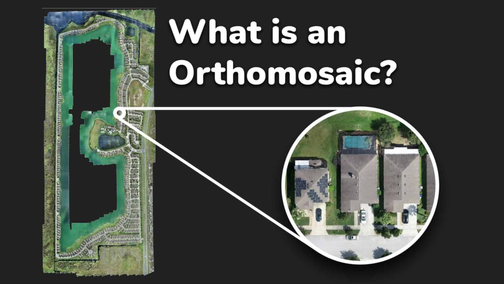
Revolutionizing Data Collection for Surveying, Construction, and Land Development Orthomosaic imaging is a cutting-edge aerial…

Stop Work Order Violation – Aerial Documentation for Legal Evidence Case Overview Our team was…
Overview A construction project in Los Angeles was issued a Stop Work Order due to…