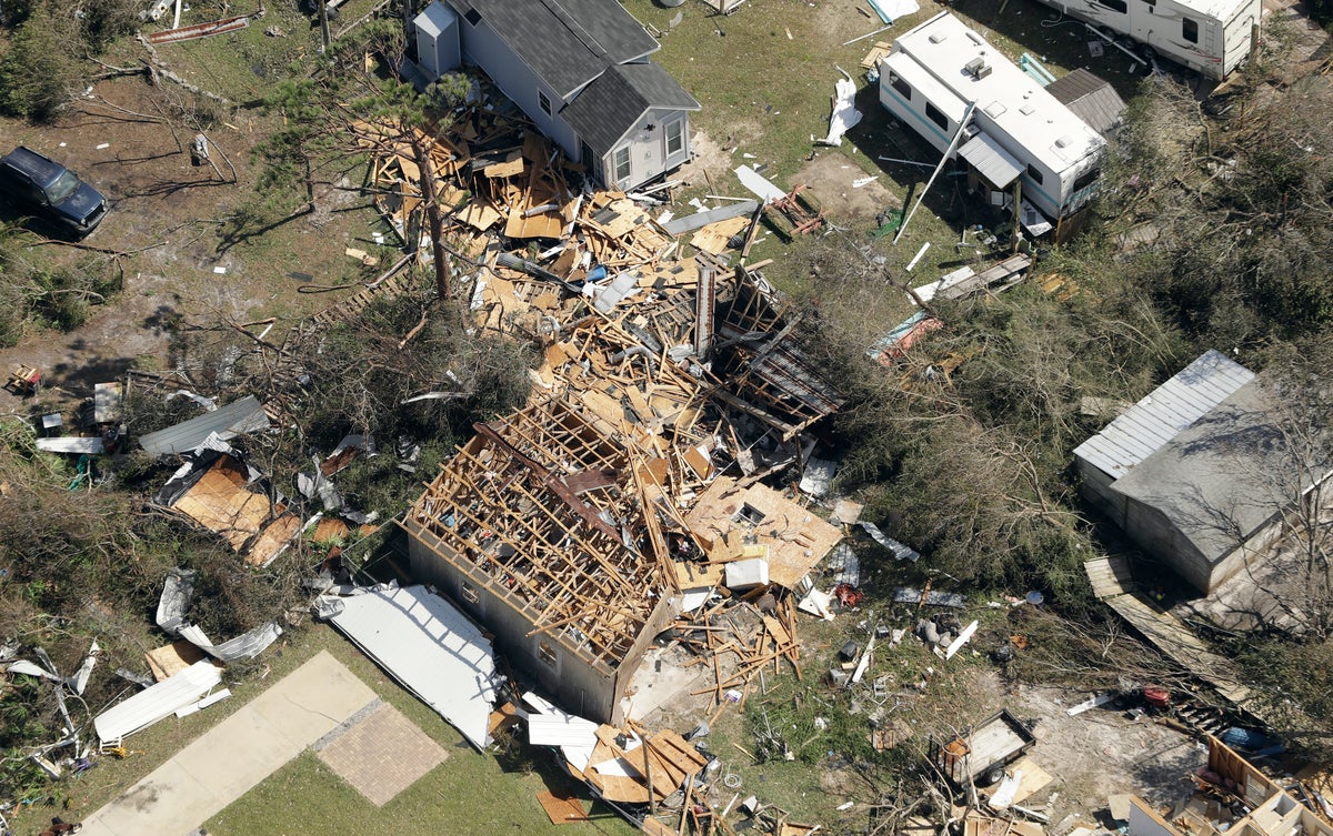

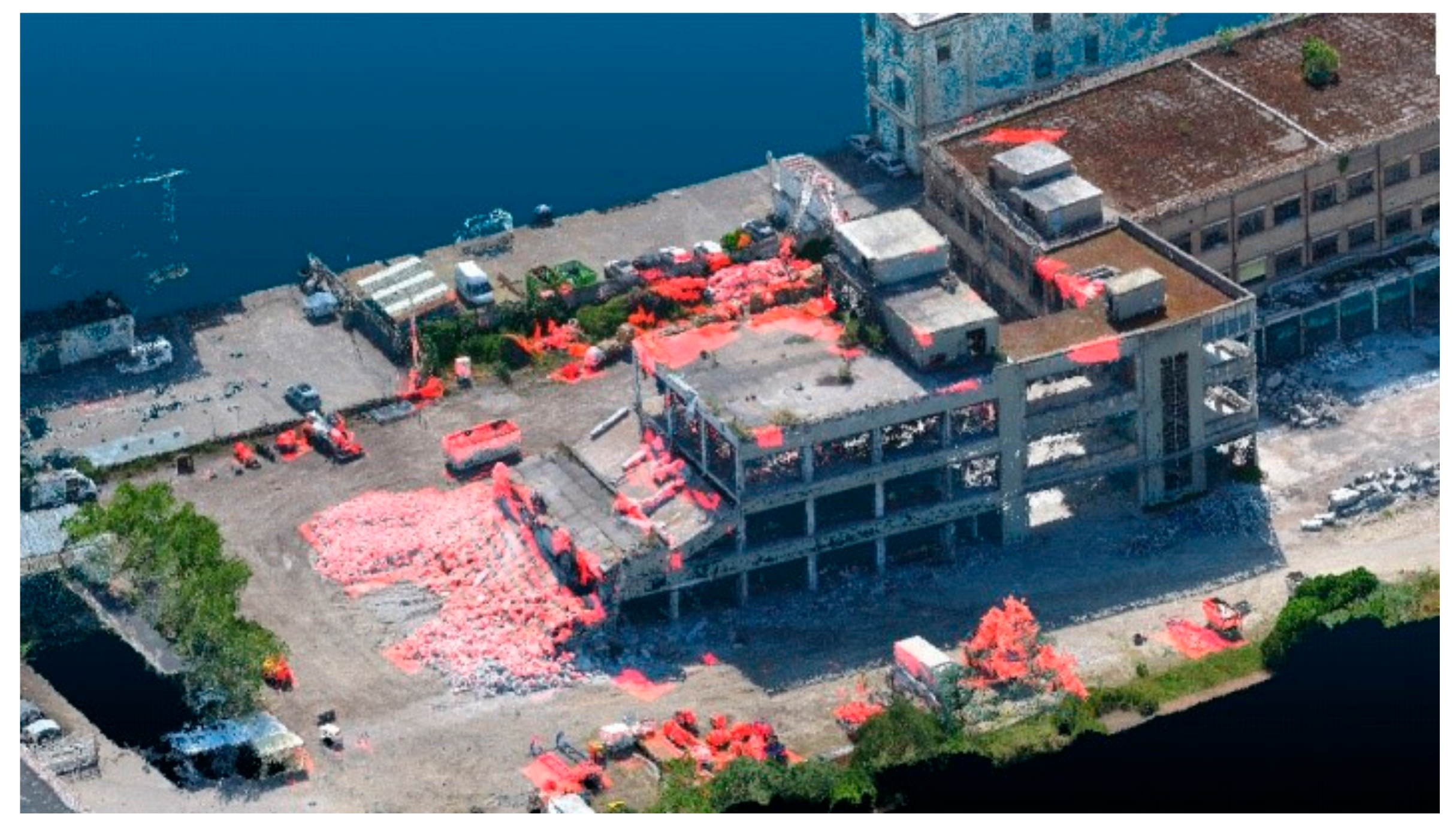
Property damage assessments require detailed and verifiable documentation to support insurance claims, legal cases, and restoration efforts. Our advanced drone technology provides high-resolution aerial imagery, 3D mapping, and thermal imaging to accurately document property damage for homeowners, businesses, and legal professionals.
Traditional property inspections can be time-consuming, limited in scope, and sometimes dangerous. Aerial documentation offers a comprehensive and accurate view of the extent of damage, ensuring that property owners, insurance adjusters, and legal teams have precise and verifiable data to support claims and assessments.
Drones can quickly assess property damage, allowing for faster claims processing and informed decision-making.
We provide high-resolution aerial images and 3D models, ensuring damage is thoroughly documented for insurance claims and restoration efforts.
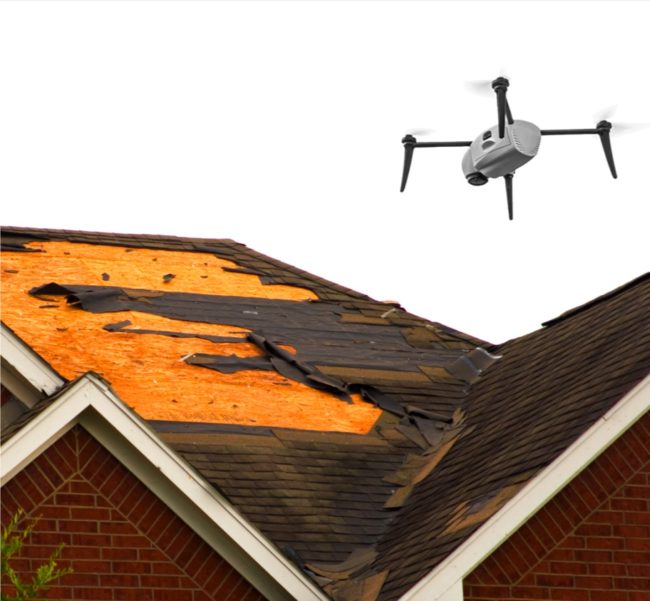
Drones eliminate the need for manual roof inspections, scaffolding, or hazardous climbs, reducing safety risks while improving accuracy
Thermal imaging can identify water intrusion, insulation failures, and electrical issues that may not be visible to the naked eye.

Bringing Unmatched Precision to Personal Injury Claims
In personal injury cases, evidence is everything. Our drone technology provides clear, court-admissible documentation that can make the difference between a successful claim and a dismissed case. Here’s how our aerial documentation strengthens your case:

Detailed aerial documentation helps insurance companies and property owners speed up damage evaluations and reduce claim backlogs.
Aerial imaging provides clear, accurate, and unbiased documentation, helping to resolve disputes efficiently.
Drones eliminate the need for expensive manual inspections and reduce potential safety risks for inspectors.
Our aerial solutions cater to homes, apartment complexes, commercial buildings, and industrial facilities.
We provide specialized aerial services designed to assist insurance professionals, legal teams, property owners, and restoration companies with high-quality documentation.
Capture the full extent of storm-related destruction.
Identify water-affected areas with precision.
Document burn patterns and structural weakening.
Validate claims with before-and-after aerial imagery.
Provide clear, unbiased documentation for negotiations.
Help adjusters and insurers with precise visual data.
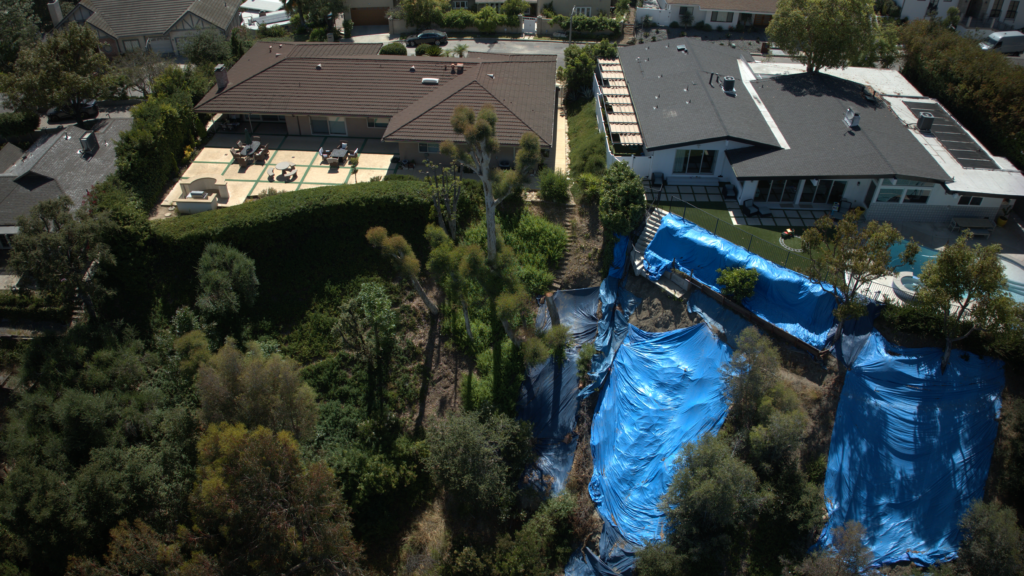
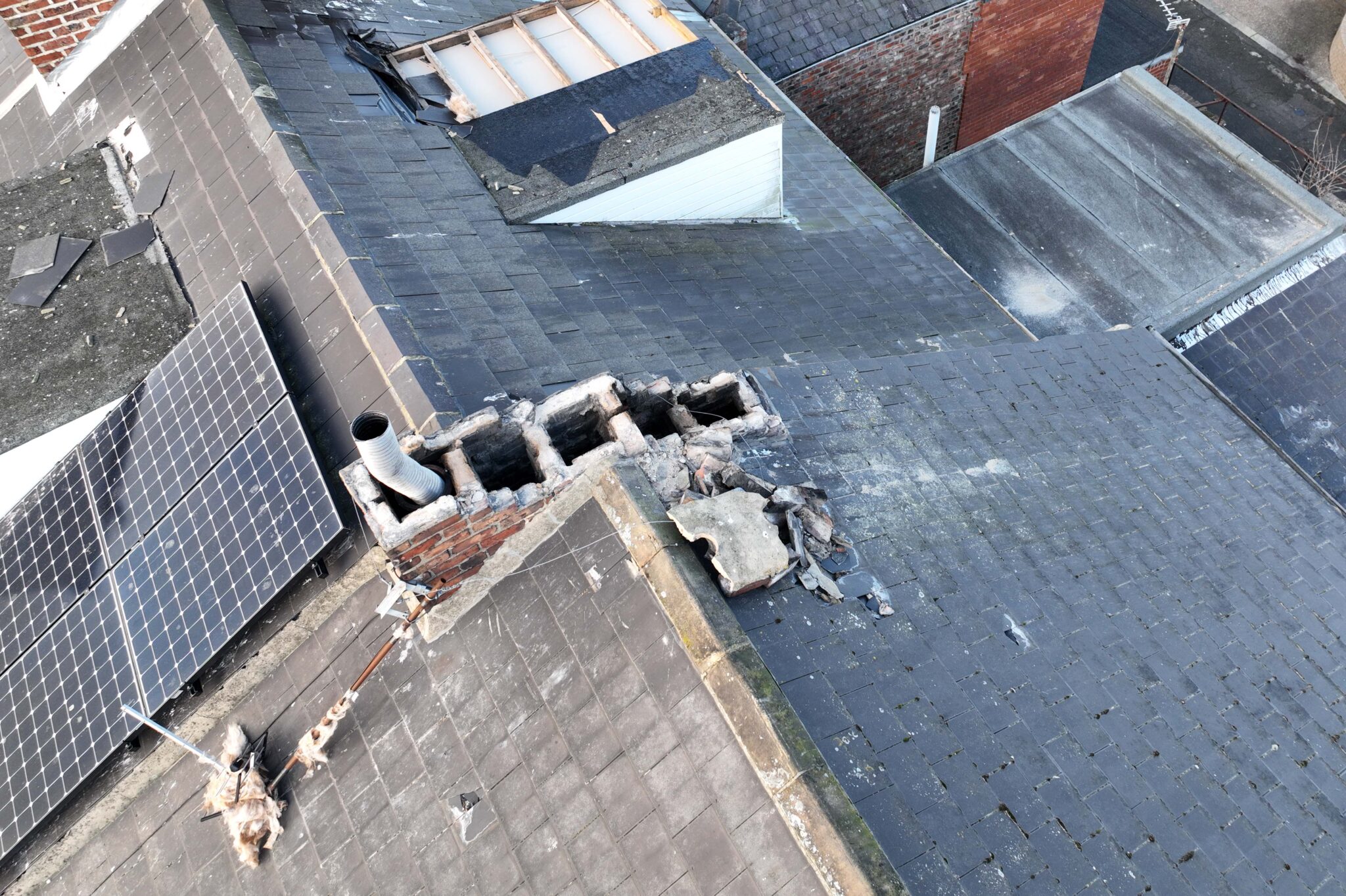
Identify leaks, cracks, and damage from above.
Assess walls, foundations, and other structural elements.
Detect underlying damage invisible to standard cameras.
Support legal cases with high-quality aerial proof.
Verify legitimate damage claims with precise imagery.
Strengthen cases with professional aerial assessments.
An insurance adjuster struggling with delayed property damage claims partnered with us to use aerial imaging for assessments. With high-resolution drone footage, they were able to reduce claim processing time by 40%, minimizing disputes and providing faster settlements for property owners.


At Hover Works, we specialize in providing high-quality aerial damage assessments for insurance claims, legal documentation, and restoration planning. Our cutting-edge drone technology ensures that every detail is captured with precision and clarity.
Contact us today to schedule your aerial property damage assessment!
At Hover Works, we provide cutting-edge aerial documentation services tailored to your needs. From accident scene investigations to real estate marketing and construction site monitoring, our drone technology ensures precision, efficiency, and impactful results. Trust us to elevate your perspective with high-quality imaging and data-