Blogs
Unlocking Unmatched Accuracy with Aerial Orthomosaic Imaging
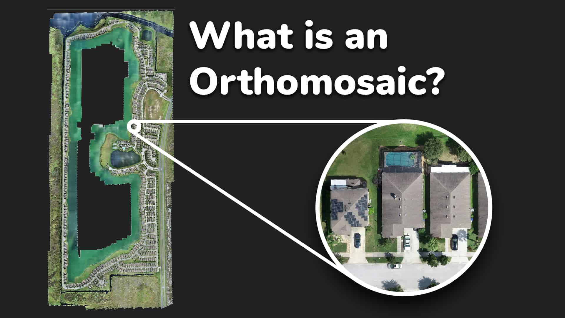
Revolutionizing Data Collection for Surveying, Construction, and Land Development Orthomosaic imaging is a cutting-edge aerial mapping technology that stitches together hundreds of high-resolution drone images