

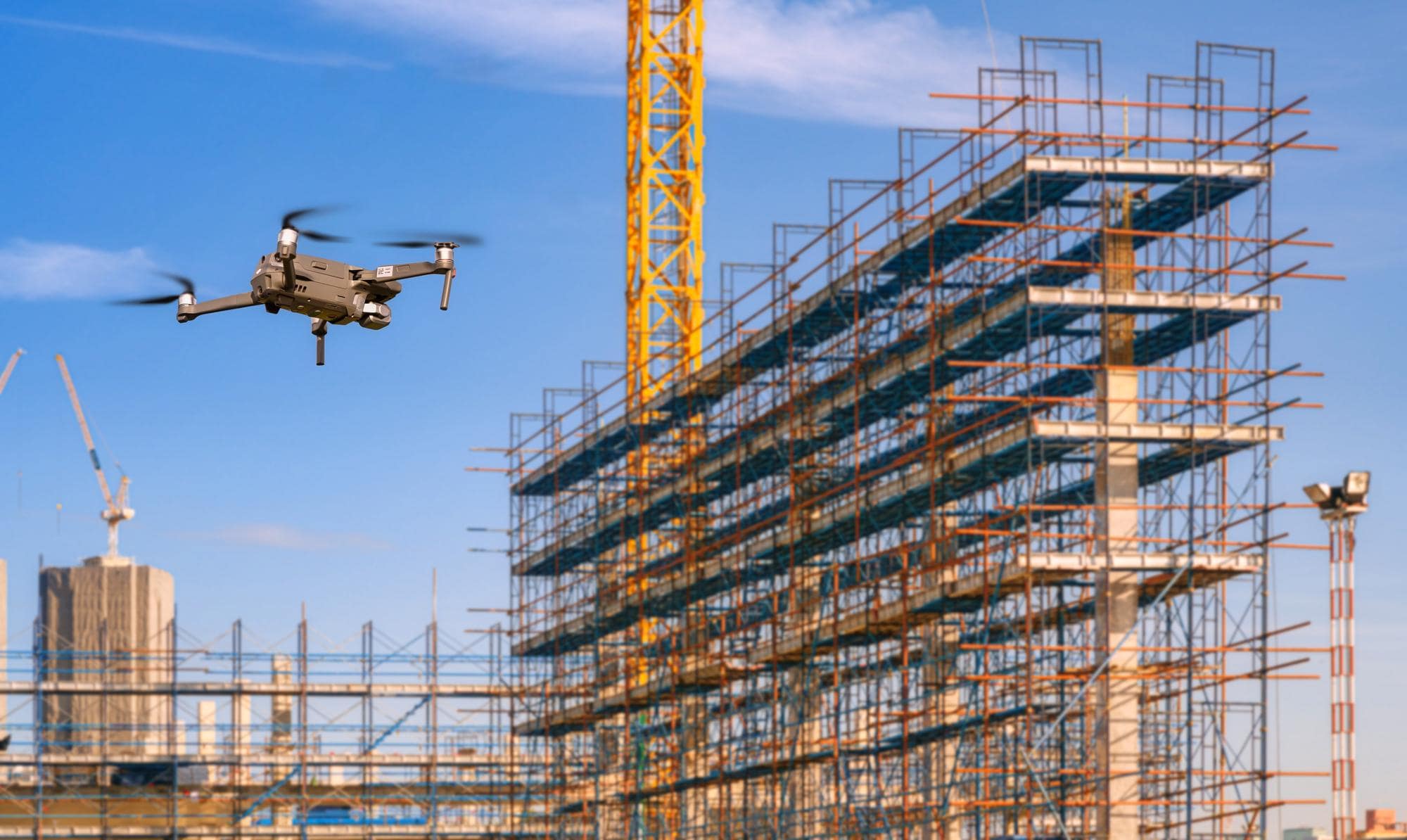
Managing construction sites and infrastructure projects requires accurate and efficient oversight. Aerial drone technology provides real-time insights, helping construction managers, engineers, and inspectors track progress, ensure safety compliance, and detect potential issues early.
Traditional site inspections can be time-consuming, costly, and sometimes hazardous. Aerial documentation eliminates these challenges by providing high-resolution visuals, 3D mapping, and real-time progress tracking, all while enhancing safety and efficiency. By leveraging drone technology, construction professionals gain a comprehensive, data-driven perspective of their projects, allowing for better decision-making and project optimization.
Drones provide consistent aerial updates of a site’s progress, helping project managers assess development timelines, allocate resources efficiently, and detect delays early.
Recommended Image: Side-by-side comparison of a construction site at different stages, showing progress over time.
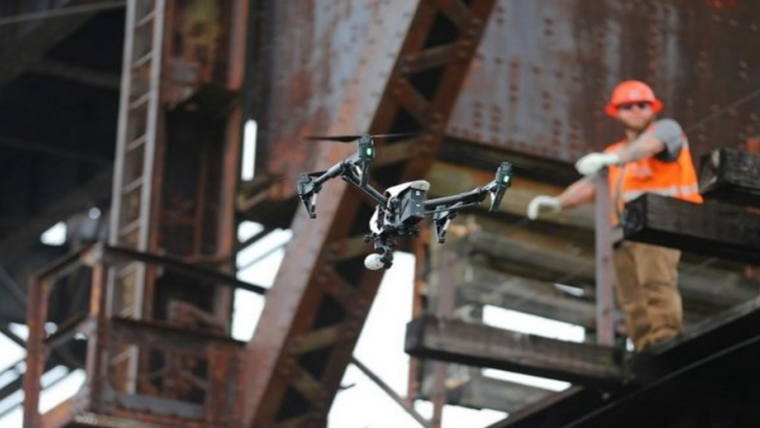
By using drones for safety assessments, construction teams can minimize on-site risks. Aerial imaging helps identify structural weaknesses, dangerous zones, and compliance issues without putting workers in harm’s way.
Recommended Image: A drone inspecting a high-rise construction project, with safety markers visible.
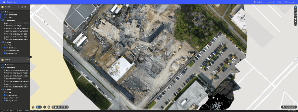
Drones generate detailed 3D maps and orthomosaic images, allowing engineers to conduct accurate site analysis, measure land contours, and plan developments effectively.
Recommended Image: A digital 3D model of a construction site, displaying elevation levels and site details.
Drones make it possible to inspect hard-to-reach infrastructure such as bridges, towers, and pipelines without requiring costly scaffolding or road closures.
Recommended Image: A drone scanning a large bridge structure, showcasing inspection efficiency.

Aerial drone technology is reshaping the construction and infrastructure industries, offering real-time insights, improving decision-making, and reducing risks. By leveraging high-resolution imaging and data analysis, construction managers can ensure their projects stay on schedule, within budget, and compliant with safety regulations. Drones provide a cost-effective and efficient alternative to traditional site monitoring, making it easier than ever to track progress, identify problems early, and maintain transparent communication with stakeholders.


Aerial data allows project managers to make quick, informed decisions, reducing costly mistakes and ensuring projects stay on track.
Using drones for inspections reduces the need for expensive scaffolding, cranes, and manual surveys, cutting costs without compromising accuracy.
Drones access hazardous locations without endangering workers, ensuring safety compliance and reducing on-site injuries.
Detailed drone reports provide visual proof of progress, helping contractors, investors, and regulators stay up to date.
We provide specialized aerial services to support construction professionals, inspectors, and government agencies with accurate and efficient project assessments.
High-resolution images and video to track development stages.
Compare progress over weeks or months with visual time-lapse recordings.
Share real-time project updates with clients, investors, and regulatory bodies
Pinpoint safety risks such as unstable structures or equipment malfunctions.
Ensure construction sites adhere to safety and environmental standards.
Detect potential issues like heat leaks, structural weaknesses, or electrical faults.
Generate precise site maps for zoning, planning, and development.
Calculate stockpile volumes, excavation areas, and terrain elevation changes.
Assist engineers with land assessments and project feasibility studies.
Capture detailed imagery for assessing wear, cracks, and structural integrity.
Inspect power lines, water pipelines, and gas infrastructure efficiently.
Identify damage or weaknesses in commercial and industrial structures.
A construction firm struggling with project delays and unexpected site issues turned to aerial drone monitoring to improve efficiency. With real-time aerial data, they were able to identify bottlenecks, improve workflow coordination, and enhance safety compliance. This led to a 20% reduction in project delays and significant cost savings.


At Hover Works, we deliver precise, high-quality aerial imaging and inspection services tailored to your construction and infrastructure needs. Improve efficiency, enhance safety, and optimize project management with our cutting-edge drone solutions.
Contact us today to schedule your aerial documentation service.
At Hover Works, we provide cutting-edge aerial documentation services tailored to your needs. From accident scene investigations to real estate marketing and construction site monitoring, our drone technology ensures precision, efficiency, and impactful results. Trust us to elevate your perspective with high-quality imaging and data-